2026-10-04 · Africa Flying
7,444 places: the list of towns our satellite pipeline looks at
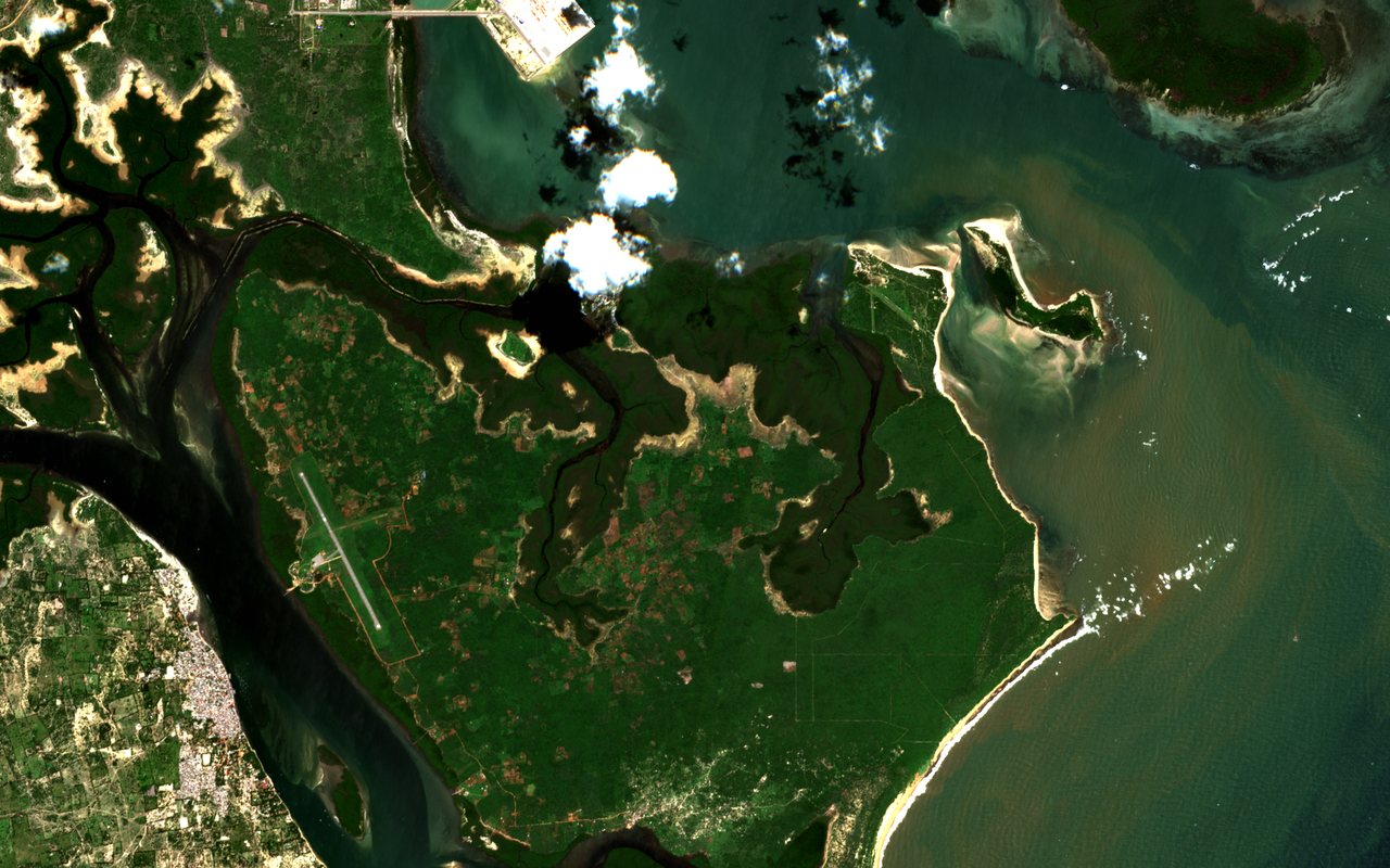
This is Lamu, on the coast of Kenya, as the Sentinel-2 satellite saw it on 27 June 2026: the island of Manda with its airstrip, and the dense roofs of Lamu town across a narrow channel. Lamu is where the LAPSSET corridor begins, and our LAPSSET page follows that corridor from the port inland. It is also one of thousands of places our pipeline needs to be able to name.
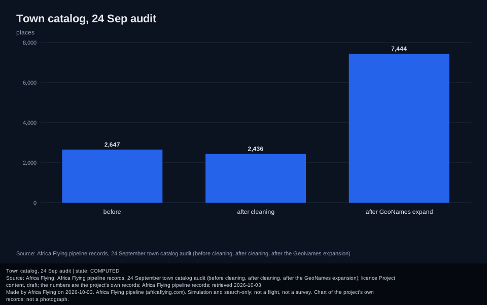
Satellite ingest needs a list of places to look at, and a list is only useful if it is clean. On 24 September 2026 we audited ours. It held 2,647 entries, and 213 of them did not belong: 112 repeated a name and country that was already there, 99 carried a leftover "(already)" tag from an earlier import, and two sat outside the Africa bounding box altogether. After cleaning, 2,436 real entries remained.
We then grew the list from the open GeoNames database of cities with more than 5,000 people, which added 5,008 places. The catalog now holds 7,444 unique places in 55 countries. The tests check that every entry has the required fields, sits inside Africa, and appears only once.
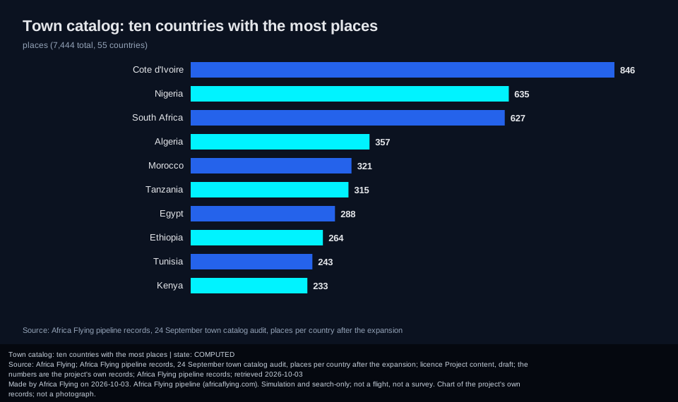
Two honest cautions. The spread is uneven, because it follows the source list: Cote d'Ivoire has the most places, then Nigeria and South Africa. That says something about how the source was compiled, not about which countries matter, and any calculation that adds up over places inherits the imbalance. And the catalog is a list of targets, not a count of satellite observations stored. How much data we hold for each place is a separate number, measured separately; the status page is where it belongs. Map data from OpenStreetMap is on our plan for roads and harbours near the corridor, but it is not part of this catalog.
Everything here is data preparation for a simulation and pre-operations platform. It is not a survey of any place, and no flight is involved.
Read next
- Two of seven: the satellite handler audit: what happens when the pipeline asks about these places.
- Withdrawing a number we could not reproduce: why a clean list matters to the model.
- Forty containers under load: what held when the whole stack was pushed.
The detail charts
The catalog in three stages, and the ten countries with the most places. Secondary to the story above.
Sources and credits
- Copernicus Sentinel-2 via Earth Search: the open STAC catalog the Lamu scene came from. Contains modified Copernicus Sentinel data 2026.
- GeoNames: the open gazetteer of place names used to expand the catalog.
- OpenStreetMap: the open map of the world, planned as a source for roads and harbours (ODbL licence).