What we are building: an R&D view built from open data. Africa Flying flies nothing in 2026; this is not an operations page.
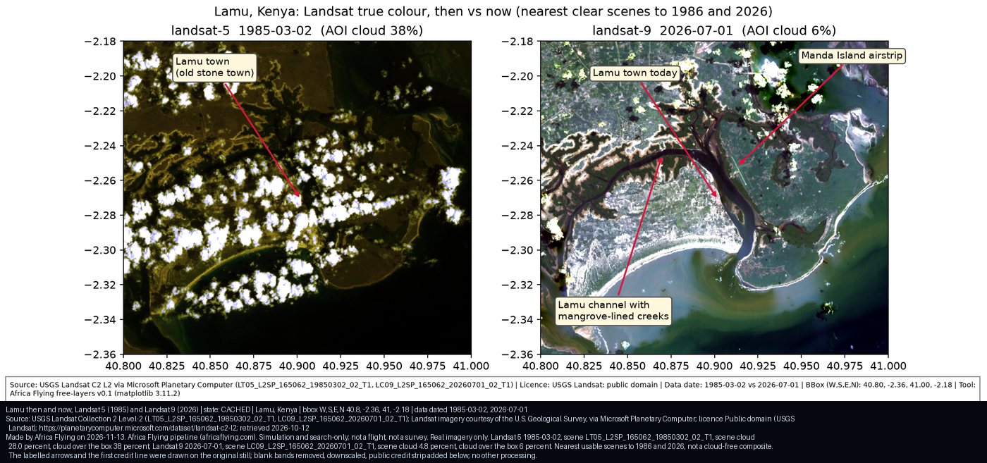
Lamu and Manda Bay from real satellite archives: the nearest usable Landsat scene to 1986 beside a 2026 scene, then 2026 Sentinel-2 views. Real acquisition dates, cloud stated, no stand-in imagery.
Baseline: 1984-90 cloud-free composite
Baseline not published yet.
A cloud-free composite of the 1984-90 Landsat archive has not been built. Until it exists this page shows single real scenes, never a stand-in image.
Then: Landsat 5, 2 Mar 1985, scene cloud 28 percent, cloud over the box 38 percent. Now: Landsat 9, 1 Jul 2026, scene cloud 4.8 percent, cloud over the box 6 percent. Nearest usable scenes to 1986 and 2026, not a cloud-free composite.Credit: Landsat imagery courtesy of the U.S. Geological Survey, via Microsoft Planetary Computer. Licence: USGS Landsat, public domain. Data date 2 Mar 1985 and 1 Jul 2026. Cached at 12 Oct 2026 (saved scenes). Provenance.
Lamu Port area, June and September 2026
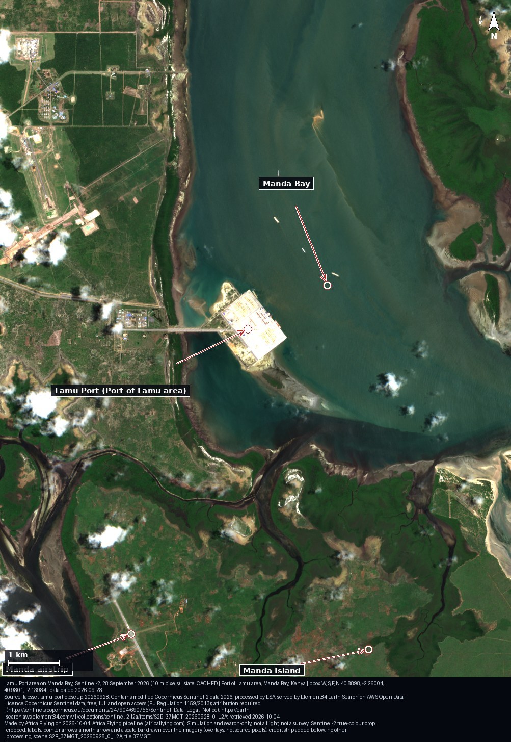
The same Sentinel-2 crop on two dates. Slide to compare; both images open unchanged below the slider.
27 Jun 2026: scene S2A_37MGT_20260627_1_L2A, whole-scene cloud 1.7 percent, 5.3 percent cloud inside the crop. 28 Sep 2026: scene S2B_37MGT_20260928_0_L2A, whole-scene cloud 23.9 percent, 3.0 percent cloud inside the crop. Labels and arrows are drawn over the imagery; the port label marks the centre of the OpenStreetMap polygon "Port of Lamu" (approximate, no berth is located).
Credit: Contains modified Copernicus Sentinel-2 data 2026, processed by ESA; served by Element84 Earth Search on AWS Open Data. Licence: Copernicus Sentinel data, free, full and open access; attribution required. Data date 27 Jun 2026 and 28 Sep 2026. Cached at 4 Oct 2026 (saved crops). Provenance: 27 Jun, 28 Sep.
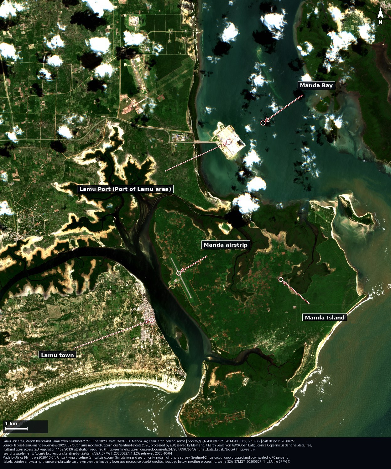
Lamu Port area, Manda Island and Lamu town, Sentinel-2, 27 Jun 2026. Whole-scene cloud 1.7 percent, 4.0 percent cloud inside the crop.Credit: Contains modified Copernicus Sentinel-2 data 2026, processed by ESA; served by Element84 Earth Search on AWS Open Data. Licence: Copernicus Sentinel data, free, full and open access; attribution required. Data date 27 Jun 2026. Cached at 4 Oct 2026. Provenance.
How we know
Landsat Collection 2 Level-2 surface reflectance (USGS, public domain) and Sentinel-2 L2A (Copernicus open data); every scene id and date is in the image record.
"Nearest usable scene" means the clearest scene found near the target year, with its cloud share stated. It is not a composite.
Every image carries a credit strip and embedded metadata; the Provenance link opens the record.
Software R&D from public satellite archives: no flight, no ground survey.