Kenya
Kenya
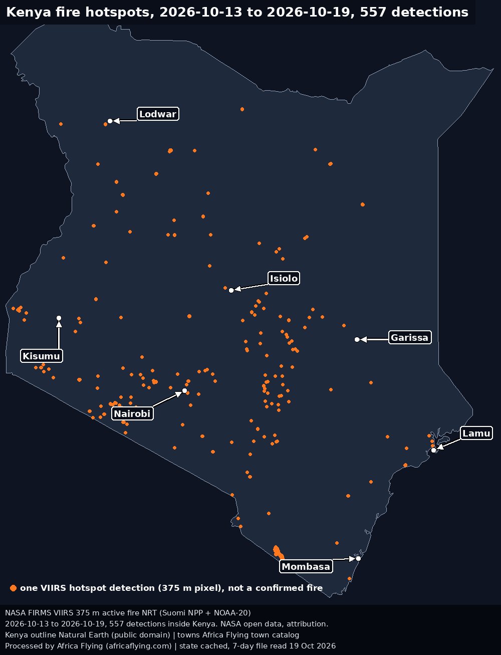
Fire hotspot map for this country is coming soon.

Nigeria candidates is a planning list. It is not a measured corridor. The open list is on airfields and ports.
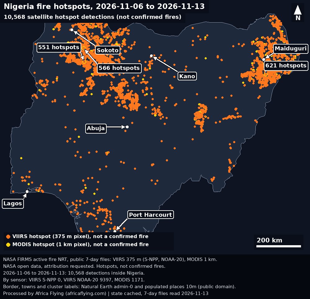

Real imagery, free data. Pre-operations R&D, no live operations.
Nothing here is deleted. Earlier runs stay below, labelled with their date. Previous runs for every country.
Trends
NDVI
Temperature
Soil moisture
Precipitation
Regions
not measured
Satellite rows
Public pipeline satellite rows.
not measured
Figures from the 17 Oct 2026 probe
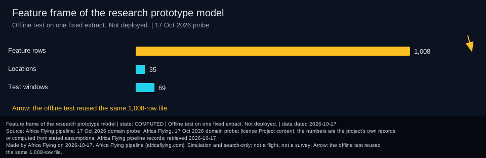
More detail
Credit: Africa Flying pipeline: 17 Oct 2026 domain probe. Licence: Project content; the numbers are the project's own records or computed from stated assumptions.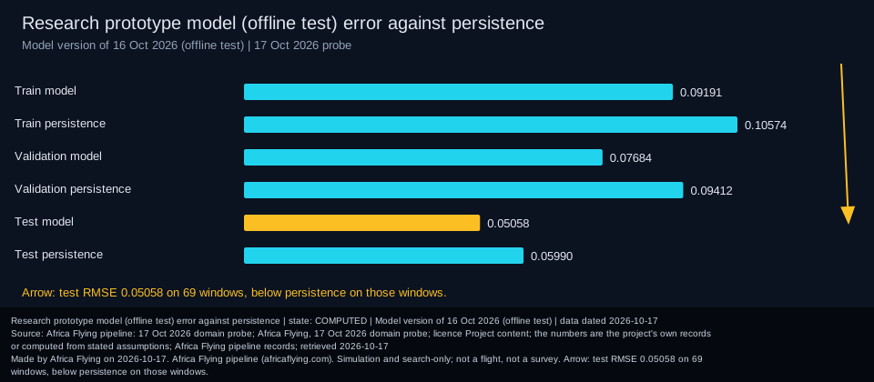
More detail
Arrow: test RMSE 0.05058 on 69 windows, below persistence on those windows.Credit: Africa Flying pipeline: 17 Oct 2026 domain probe. Licence: Project content; the numbers are the project's own records or computed from stated assumptions.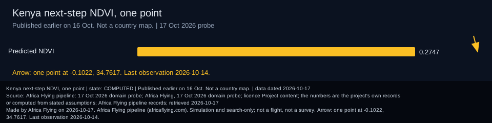
More detail
Arrow: one point at -0.1022, 34.7617. Last observation 2026-10-14.Credit: Africa Flying pipeline: 17 Oct 2026 domain probe. Licence: Project content; the numbers are the project's own records or computed from stated assumptions.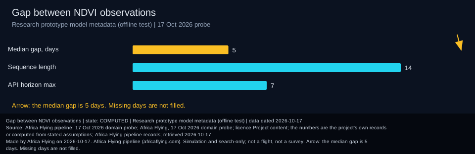
More detail
Arrow: the median gap is 5 days. Missing days are not filled.Credit: Africa Flying pipeline: 17 Oct 2026 domain probe. Licence: Project content; the numbers are the project's own records or computed from stated assumptions.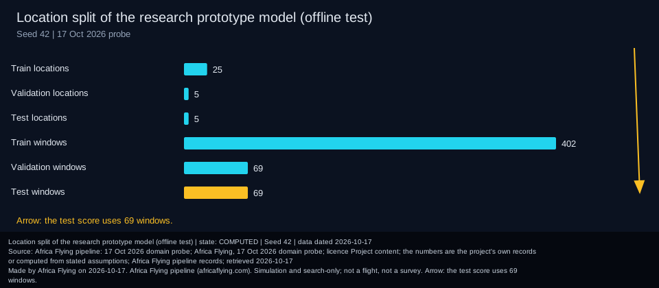
More detail
Arrow: the test score uses 69 windows.Credit: Africa Flying pipeline: 17 Oct 2026 domain probe. Licence: Project content; the numbers are the project's own records or computed from stated assumptions.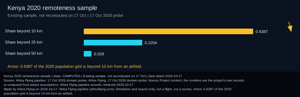
More detail
Arrow: 0.6387 of the 2020 population grid is beyond 10 km from an airfield.Credit: Africa Flying pipeline: 17 Oct 2026 domain probe. Licence: Project content; the numbers are the project's own records or computed from stated assumptions.Sentinel-2 crops of the stored Kenya LAPSSET anchors. Corridor numbers on this page stay the public summary.
More detail
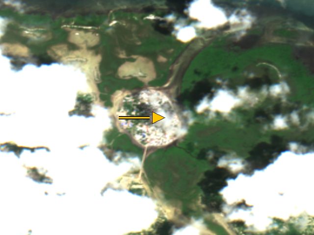
The arrow marks the stored coordinate (-2.056, 41.112), not a surveyed building. Whole-scene cloud cover 21.1 percent.Credit: Contains modified Copernicus Sentinel-2 data 2026, processed by ESA; served by Element84 Earth Search on AWS Open Data. Licence: Copernicus Sentinel data, free, full and open access (EU Regulation 1159/2013); attribution required.
More detail
The arrow marks the stored coordinate (-2.178, 40.819), not a surveyed building. Whole-scene cloud cover 21.1 percent.Credit: Contains modified Copernicus Sentinel-2 data 2026, processed by ESA; served by Element84 Earth Search on AWS Open Data. Licence: Copernicus Sentinel data, free, full and open access (EU Regulation 1159/2013); attribution required.
More detail
The arrow marks the stored coordinate (-2.1983, 40.9336), not a surveyed building. Whole-scene cloud cover 21.1 percent.Credit: Contains modified Copernicus Sentinel-2 data 2026, processed by ESA; served by Element84 Earth Search on AWS Open Data. Licence: Copernicus Sentinel data, free, full and open access (EU Regulation 1159/2013); attribution required.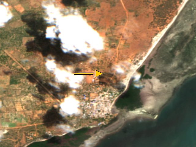
More detail
The arrow marks the stored coordinate (-1.74, 41.49), not a surveyed building. Whole-scene cloud cover 21.5 percent.Credit: Contains modified Copernicus Sentinel-2 data 2026, processed by ESA; served by Element84 Earth Search on AWS Open Data. Licence: Copernicus Sentinel data, free, full and open access (EU Regulation 1159/2013); attribution required.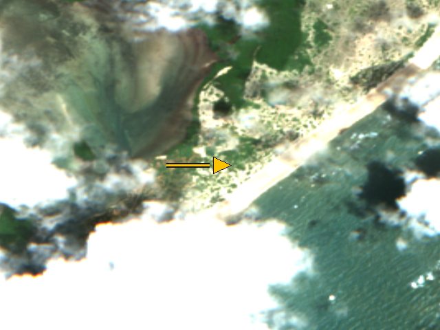
More detail
The arrow marks the stored coordinate (-2.012, 41.27), not a surveyed building. Whole-scene cloud cover 21.1 percent.Credit: Contains modified Copernicus Sentinel-2 data 2026, processed by ESA; served by Element84 Earth Search on AWS Open Data. Licence: Copernicus Sentinel data, free, full and open access (EU Regulation 1159/2013); attribution required.
More detail
The arrow marks the stored coordinate (-2.2667, 40.9), not a surveyed building. Whole-scene cloud cover 21.1 percent.Credit: Contains modified Copernicus Sentinel-2 data 2026, processed by ESA; served by Element84 Earth Search on AWS Open Data. Licence: Copernicus Sentinel data, free, full and open access (EU Regulation 1159/2013); attribution required.
More detail
The arrow marks the stored coordinate (-2.2717, 40.902), not a surveyed building. Whole-scene cloud cover 21.1 percent.Credit: Contains modified Copernicus Sentinel-2 data 2026, processed by ESA; served by Element84 Earth Search on AWS Open Data. Licence: Copernicus Sentinel data, free, full and open access (EU Regulation 1159/2013); attribution required.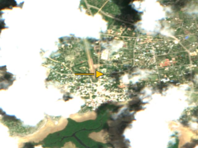
More detail
The arrow marks the stored coordinate (-2.234, 40.847), not a surveyed building. Whole-scene cloud cover 21.1 percent.Credit: Contains modified Copernicus Sentinel-2 data 2026, processed by ESA; served by Element84 Earth Search on AWS Open Data. Licence: Copernicus Sentinel data, free, full and open access (EU Regulation 1159/2013); attribution required.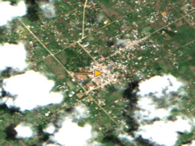
More detail
The arrow marks the stored coordinate (-2.38913, 40.69812), not a surveyed building. Whole-scene cloud cover 21.6 percent.Credit: Contains modified Copernicus Sentinel-2 data 2026, processed by ESA; served by Element84 Earth Search on AWS Open Data. Licence: Copernicus Sentinel data, free, full and open access (EU Regulation 1159/2013); attribution required.
More detail
The arrow marks the stored coordinate (-2.142, 40.998), not a surveyed building. Whole-scene cloud cover 21.1 percent.Credit: Contains modified Copernicus Sentinel-2 data 2026, processed by ESA; served by Element84 Earth Search on AWS Open Data. Licence: Copernicus Sentinel data, free, full and open access (EU Regulation 1159/2013); attribution required.
More detail
The arrow marks the stored coordinate (-2.293, 40.914), not a surveyed building. Whole-scene cloud cover 21.1 percent.Credit: Contains modified Copernicus Sentinel-2 data 2026, processed by ESA; served by Element84 Earth Search on AWS Open Data. Licence: Copernicus Sentinel data, free, full and open access (EU Regulation 1159/2013); attribution required.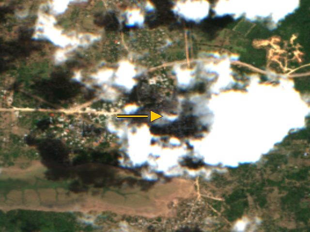
More detail
The arrow marks the stored coordinate (-2.38892, 40.43827), not a surveyed building. Whole-scene cloud cover 19.3 percent.Credit: Contains modified Copernicus Sentinel-2 data 2026, processed by ESA; served by Element84 Earth Search on AWS Open Data. Licence: Copernicus Sentinel data, free, full and open access (EU Regulation 1159/2013); attribution required.Coverage map (partial) · LAPSSET · Infrastructure map · Satellites