Home Nigeria candidates LAPSSET

Nigeria hotspot compare

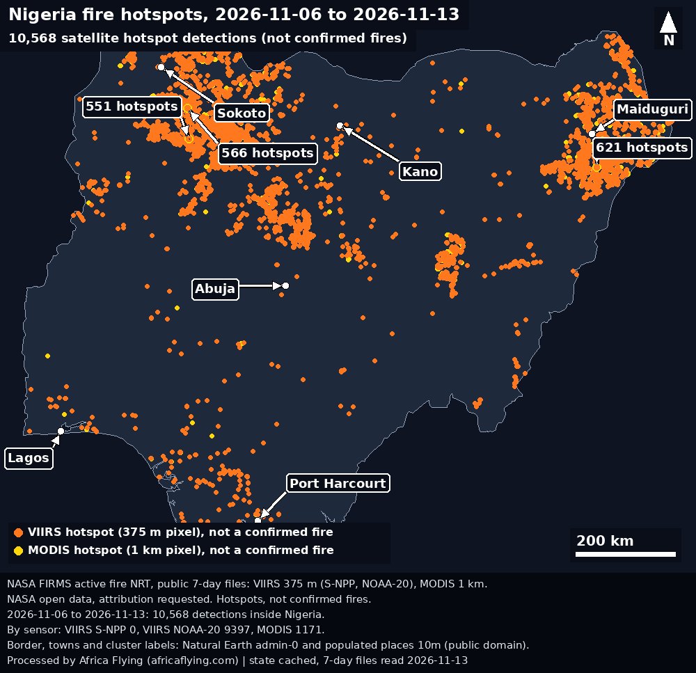
Two saved Nigeria maps. 12–19 Oct 2026 has 5,664 detections. 6–13 Nov 2026 has 10,568. Each dot is a detection, not a confirmed fire, and not a construction monitor.

The counts differ. That difference is not a finding that fires increased, and it is not a measure of the ten planning projects. Nigeria candidates remains a planning list, not a measured corridor.
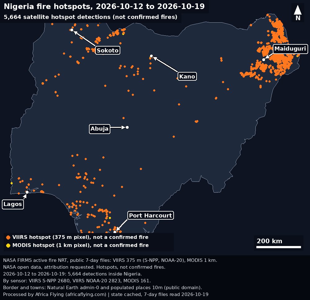
Map of Nigeria with NASA FIRMS hotspot detections from 12 to 19 October 2026. Each dot is a detection, not a confirmed fire, and not a construction monitor.
Nigeria hotspot detections, 12–19 Oct 2026: 5,664. NOAA-20 2,823, S-NPP 2,680, MODIS 161.Credit: NASA FIRMS, processed by Africa Flying. Outline: Natural Earth. Licence: NASA open data. Provenance.
Map of Nigeria with NASA FIRMS hotspot detections from 6 to 13 November 2026. Each dot is a detection, not a confirmed fire, and not a construction monitor.
Nigeria hotspot detections, 6–13 Nov 2026: 10,568. NOAA-20 9,397, S-NPP 0, MODIS 1,171.Credit: NASA FIRMS, processed by Africa Flying. Outline: Natural Earth. Licence: NASA open data. Provenance.

October sensors in the saved file: NOAA-20 2,823, S-NPP 2,680, MODIS 161. November sensors in the saved file: NOAA-20 9,397, S-NPP 0, MODIS 1,171. No observed corridor video is stored. This is not a flight clearance.