2026-10-04 · Africa Flying
Seven satellite sources, two that really worked
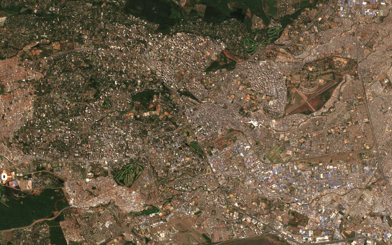
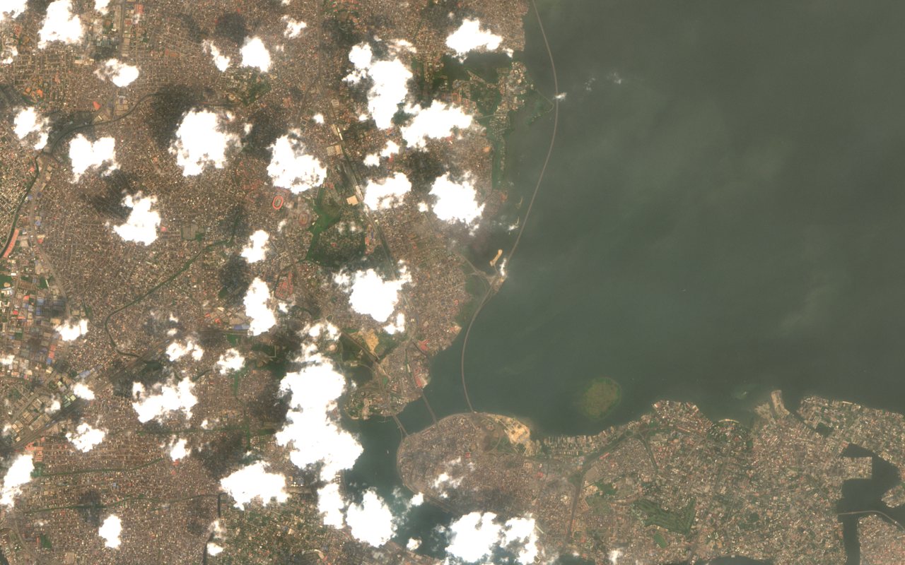
These are the two cities we used for the test, as Sentinel-2 saw them in 2026: Nairobi on 12 August and Lagos on 24 January. On 24 September 2026 we asked every one of our seven satellite handlers for real data about these two places, and wrote down what actually came back, not what we hoped.
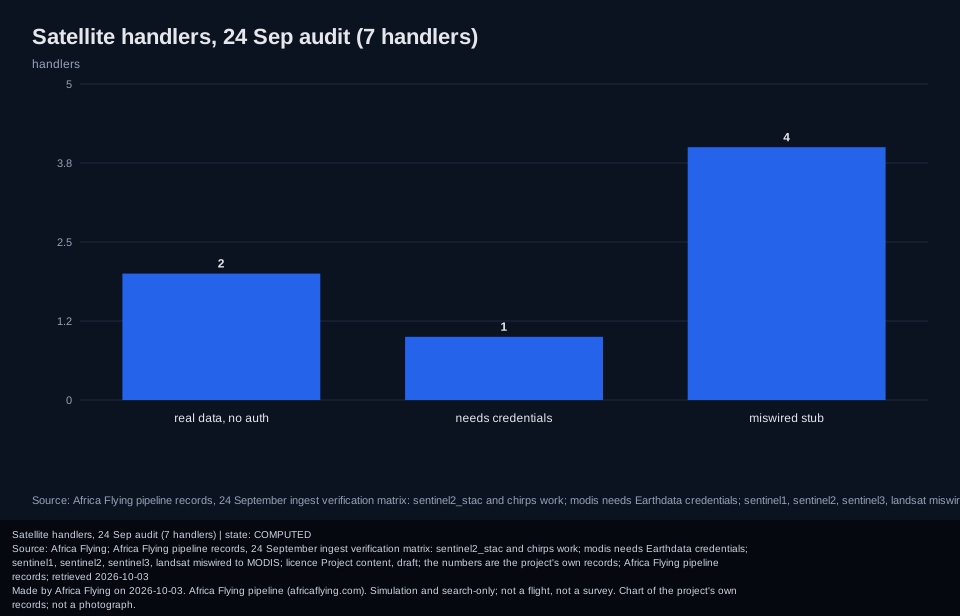
Two worked. One reads Sentinel-2 images through the open Earth Search catalog, which follows the STAC standard for describing satellite data. The other reads daily rainfall from the open CHIRPS record. Neither needs a login. One needs credentials: the MODIS handler needs a NASA Earthdata account, and now says so.
Four were wrong. The Sentinel-1, Sentinel-2, Sentinel-3 and Landsat handlers were all wired to the same MODIS code, so a request for one satellite would have been answered by another. They are now reported as needing authentication rather than returning something that merely looks like data.
The rule that came out of it is short: an empty answer must say why. Every handler now returns one of three plain outcomes, no data, needs login, or error, and never a silent empty success. A test walks the whole registry so a future handler cannot skip the rule. Native Landsat from Earth Search needs a paid-requester cloud account, so we do not fake it. The sources are described in the project documents and shown on the satellites page; the live health of the services is on the status page.
This is data plumbing for a simulation and pre-operations platform. A satellite scene is a record of the ground, not of any aircraft, and nothing here is a flight claim.
Read next
- Forty containers under load: the stress test the whole stack went through two days later.
- 7,444 places: the list these handlers are asked about.
- Six commits to an MCP server: the tool layer that reports where each answer came from.
The detail chart
The seven handlers by verified status. Secondary to the story above.
Sources and credits
- Copernicus Sentinel-2: the European programme behind the Sentinel satellites. Images: contains modified Copernicus Sentinel data 2026.
- Earth Search by Element84: the open STAC catalog that serves Sentinel-2 scenes.
- CHIRPS: open rainfall data from the UC Santa Barbara Climate Hazards Center.
- NASA Earthdata: where the MODIS account is requested.