Airfields and ports, mapped from open data
That country is not in the catalog.
Kenya, below, is the saved second-source check. Every other catalog country loads its OurAirports and World Port Index list from 13 Oct 2026. The index of those lists is the open-list index. That list is not a route map.
Open list
Kenya's listed airfields and ports, mapped from open data, not a route map.
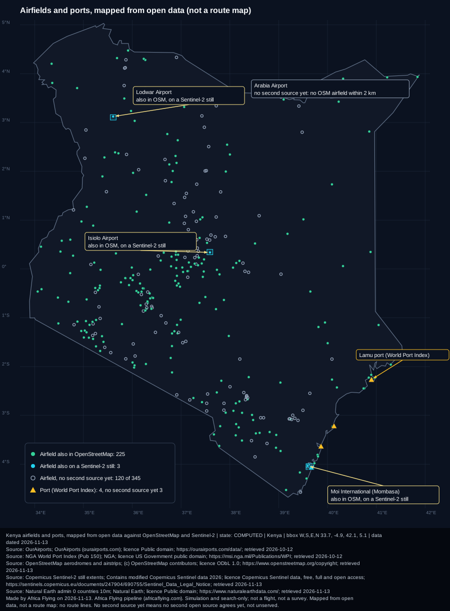

More detail
OurAirports and World Port Index lists retrieved 12 Oct 2026; OpenStreetMap aerodromes read 13 Nov 2026; Sentinel-2 still extents as published on the site. Cached at 13 Nov 2026 (saved map and table).What open data shows
| List | Listed | Also in OpenStreetMap (2 km) | On a published Sentinel-2 still | No second source yet |
|---|---|---|---|---|
| Airfields (OurAirports) | 345 | 225 | 3 | 120 |
| Ports (World Port Index) | 4 | not checked yet | 1 | 3 |
How we know
- An airfield counts as "also in OpenStreetMap" when a mapped aerodrome or airstrip lies within 2 km of the listed point.
- "On a Sentinel-2 still" means the point falls inside a satellite image already published on this site. More stills will give those sites a second source.
- Ports are not yet checked against OpenStreetMap: coming.
- Software R&D from open lists: no flight, no ground visit, no route planning.